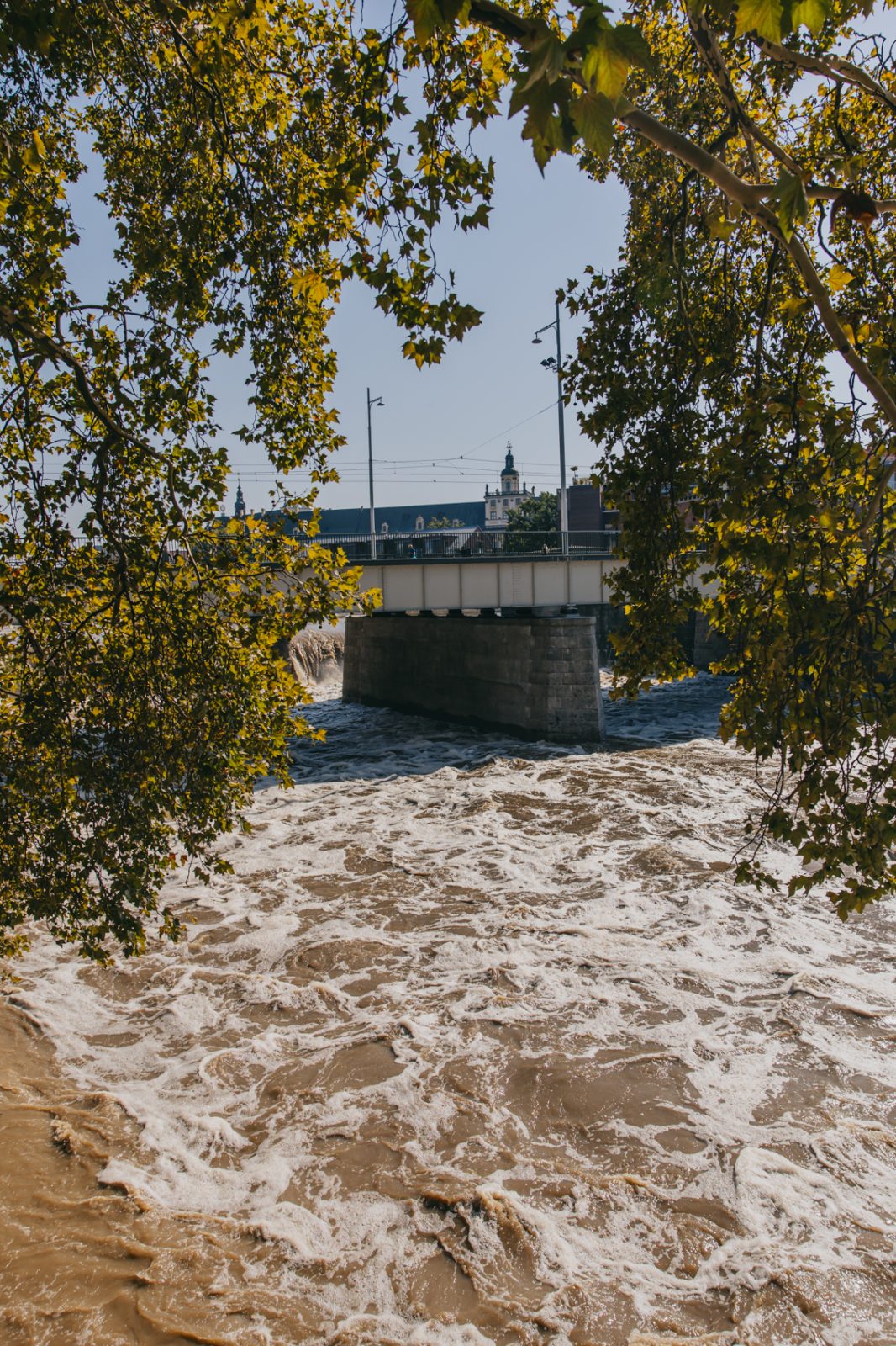
Flooding in Wrocław: our geographers act!
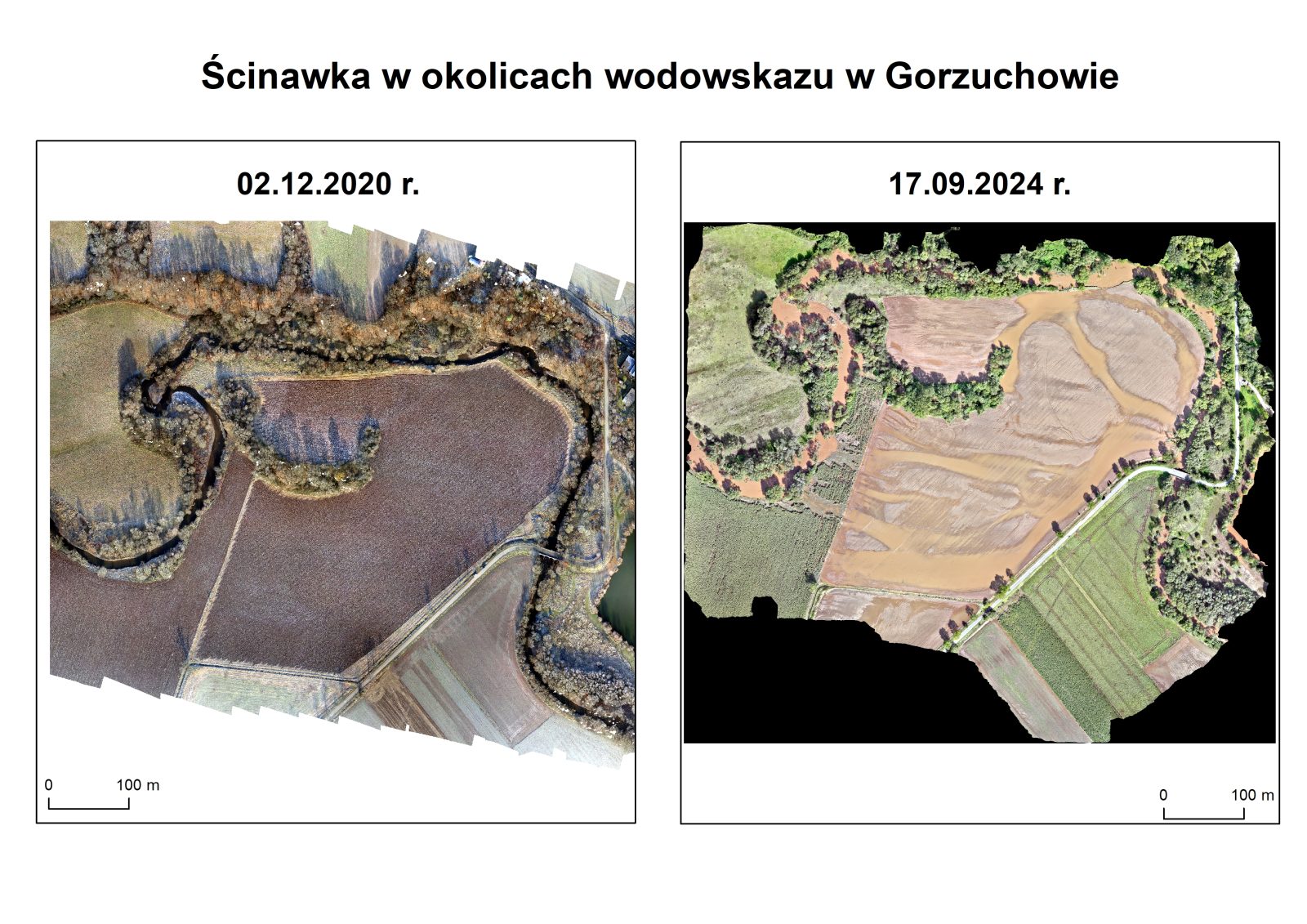
The Institute of Geography and Regional Development has been conducting research related to hydrological forecasting for more than a decade, in which drones are used to verify the results. Our scientists are also carrying out research into changes in the landscape caused by storm surges.
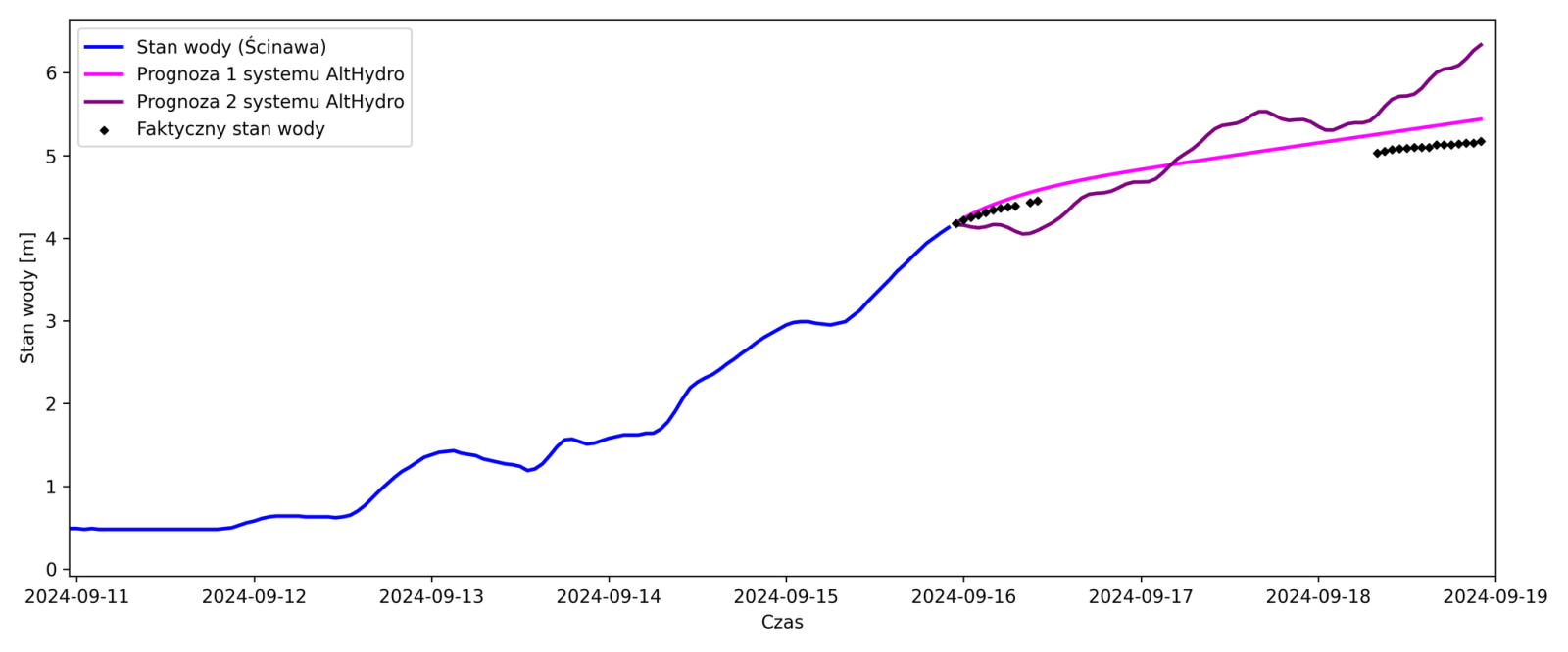
These projects include the HydroProg system tested in the Kłodzko area, based on hydrological data from the Local Flood Protection System of the Kłodzko district. Currently, the possibility of using satellite data to forecast water levels in unmonitored river sections is being investigated and verified using drones (AltHydro project, middle Oder valley).
In the current situation, the AltHydro system has been used to try to forecast the surge for the Ścinawa water gauge. Preliminary forecasts show the high accuracy of the system. Our team is currently working on launching a map portal with forecasts for unmonitored river sections.
Researchers from the Laboratory of Unmanned Aerial Earth Observation have collected data using drones over some flood-affected areas (at the moment, this is not possible everywhere due to no-fly zones, reserved only for emergency services). In the near future, our researchers from the UWr Institute of Geography and Regional Development plan to conduct measurement campaigns (aerial and ground-based) on a larger scale.