Gobi and Mongolia under the eye of Polish archaeologists
Apart from the missions of Polish palaeontologists in the 1960s and 1970s, archaeologists from the University of Wrocław are the only scientists from Poland working actively in the Gobi and southern Mongolia. They have just returned from another expedition.
Which is the expedition of our scientists to Mongolia?
Grzegorz Michalec, UWr Institute of Archaeology – This year’s expedition was the third season of excavations as part of the ongoing project ‘Around Tsakhiurtyn Hondi. Study on stone age in Altai and Gobi Desert frontier in Mongolia’, conducted by researchers from the Institute of Archaeology of the University of Wrocław.
When did you start your research in this part of the world?
The activity of our archaeologists in Mongolia, started several years ago. In 2015, prof. Mirosław Masojć and prof. Józef Szykulski, at the invitation of the Mongolian side (Institute of Archaeology of the Mongolian Academy of Sciences and Ulaanbaatar University of Education), signed a cooperation agreement. Thanks to the establishment of contacts, it was possible to carry out the first reconnaissance and surface research in 2015-2016, which resulted in the current project.
It is worth noting that, apart from the thriving missions of Polish palaeontologists in the 1960s and 1970s, we are the only scientists from Poland working actively in the Gobi region of Mongolia.
Did anything distinguish it, did anything surprise you?
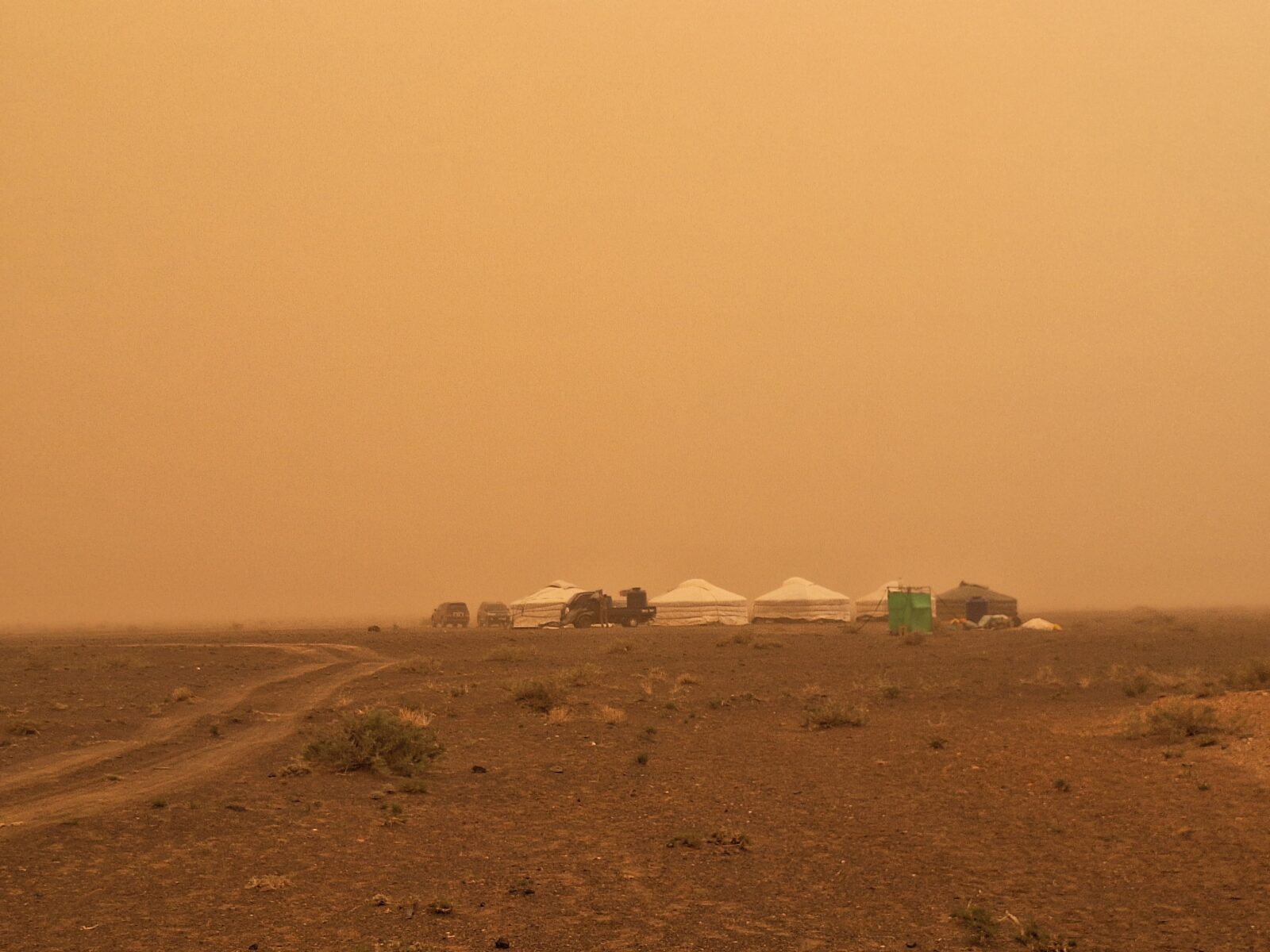
This year, certainly the weather! We are working in one of the driest areas in the world; the annual average rainfall is less than a few tens of millimetres, and we managed to experience a huge downpour, lasting continuously for 24 hours! This caused major difficulties. One of the cars got stuck in the mud on the way to the site. Fortunately, we always have satellite phones with us, so we called our colleagues for help.
And from the scientific side?
An important fact, which distinguishes the other seasons, was the presence for several days of palaeogeneticists from Yale University, led by dr Diyendo Massilani. Their task was to collect sediment samples from a cave site located in the Arts Bogd Nurr Massif, from which they will attempt to extract human DNA residues.
Another thing that set this season apart was the length of our stay in the field. This year we spent more than five weeks in the Gobi Altai area, which was the longest period of our work of all three seasons.
What conditions did you usually work under?
Not easy. Sandstorms, strong winds, high temperatures exceeding 35 degrees Celsius and even the previously mentioned heavy rainfall. And on top of this, the lack of access to running water, a poor diet based on local produce and living in a small space in yurts do not make the living situation any easier either.
Any advantages?
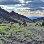
Definitely communing with nature in a state almost completely untransformed by the ubiquitous anthropopressure. Imagine, perfectly visible at night, the stars and the Milky Way. The camp is located at the foot of the mountains, so we had a great vantage point, and a naked-eye view extending for several tens of kilometres. The variation in light exposure throughout the day makes the same places look completely different – different colours, differently cast shadow; it makes you discover the beauty of the places anew with each passing moment. The same is true of the fauna we had the chance to observe – horses, camels, gazelles and many, many more.
Where did the idea of exploring this area come from?
We are not the first archaeologists working in the area. In the late 1980s and early 1990s, a Mongolian-Russian-American expedition worked here. Their main achievement was the discovery of a series of outcrops of siliceous rocks (mainly flint and chalcedony), identified as the Flint Valley. According to their findings, based on analyses of the technological characteristics and state of preservation of the concentrations of stone artefacts discovered on the surface, these outcrops were exploited mainly by hunter-gatherer communities during the Pleistocene epoch.
Our task was to verify previous findings, as well as to try to reconstruct a time frame for human activity in prehistory, reconstructing the technological behaviour and survival strategies of these communities.
Another factor that had a significant impact on undertaking further research activities in our project was the discovery of five palaeochannels and traces of settlement around them that had previously gone unrecorded. In the course of these several years of research, we were able to trace a total of more than 150 sites above the palaeochannels and in the mountainous area further north.
What tools does the modern archaeologist use?
I assume that in the general consciousness there is still a perception of archaeologists as ‘treasure hunters’ of the Indiana Jones type. I will probably disappoint many people, but our work has nothing to do with such an image created by pop culture.
We are scientists who have as our main task to learn about man living in the past. We want to find out how they adapted to changing environmental conditions, what survival strategies they used, what they ate, as well as the nonutilitarian aspects related to beliefs and perceptions of the surrounding reality are also the source of our inquiries.
In our work, we use the latest technological advances to help us learn about the past. The first step, which involves observing the variability of the landscape and terrain, can already be done while working in the office, in Poland. Satellite images are a great source of information in the search for remnants of lakes and watercourses that were once present in the selected area.
The next stage is surface prospecting. Here we use handheld GPS to locate newly discovered sites and traces of past human activity in space.
In the course of the excavations themselves, we use GNSS RTK and total station, in a combined hybrid system, to achieve the most accurate location of objects in space. In order to accurately document the stratigraphic situation, i.e. the layers that have formed over time, as well as the remains of various objects (e.g. hearths and concentrations of stone monuments), we employ a range of new possibilities – from aerial documentation using a drone, to photogrammetric modelling and 3D scanning.
Of course, the exploration of the layers and objects themselves, is very tedious and requires a lot of patience. Great care must be taken and millimetre by millimetre, all remains must be uncovered. The excavated sediments themselves, are later dry sieved or wet flotation on screens. The method of screening depends on the nature of the site and the sediments present. In this way, we are able to avoid missing small objects or animal remains, which are a valuable source of information.
Is this actually interdisciplinary research?
Yes, that is why we are keen to enlist the help of our colleagues from other scientific disciplines who collaborate with us: geologists, geophysicists, archaeozoologists, palaeogeneticists, etc. They all analyse the material and samples we collect in terms of the different information we want to acquire, e.g. about the formation process of the site, the climatic and environmental conditions during the human presence, the dating of the sites.
After the excavation phase, I move on to further analyses of the information obtained.
The monumental material is analysed from a technological point of view, using elaborate methods of archaeological analysis: we classify and describe the technological features of the monuments, we carry out so-called folding studies – that is, we try to put together the resulting elements from the production of stone tools into a whole, a kind of 3D jigsaw puzzle, and the micro traces created during the use and production of the tools are examined under the microscope.
Spatial data acquired at the site, are analysed using GIS tools, allowing us to reconstruct the process of how the site was created, as well as to define the functional zones of the habitation area.
Do local authorities always have priority in publishing information about important finds?
According to the agreement between our University and the Mongolian institutions, all parties to the project have equal access to the research results, and their publication is done in cooperation and by mutual agreement. Therefore, we try to work in two tracks; we are responsible for popularising the results within our country, and the Mongolian side makes the same effort in their country. Scientific and popularisation publications of international scope, also require the agreement of both parties. An interesting initiative to popularise our project, the results of which saw the light of day this year, was a comic book about our research in Mongolia.
So let’s try to summarise the research. What did you find?
Over the last three seasons of the project, we have achieved a great deal. Let me just cite the most important results of our activities.
First, I will focus on our activities at Khutul Usny cave (site FV8), located in one of the valleys of the Arts Bogd Nuruu massif, where I have had the pleasure of directing work for the last three seasons of work.At this site, excavations have confirmed two major episodes of cave settlement – the younger dating to the early Holocene (c. 10,000 years ago), and the older dating to c. 26-24,000 years ago, a period associated with the onset of the Last Glacial Maximum (LGM).
The analysis of the discovered faunal remains (conducted under the supervision of dr hab. Marta Osypińska, prof. UWr), together with ZooMS analysis conducted at York University, will allow us to determine the species structure and carry out environmental reconstructions for different periods of the site’s settlement.
What did you particularly enjoy?
The discovery of numerous bone beads and stone artefacts characteristic of the Upper Palaeolithic (the period associated with the presence of Homo sapiens in the late Pleistocene) in layer VII. Pleistocene faunal remains from this layer have been disbursed by AMS method C14 to 26,000 years ago. Nevertheless, significant traces of human activity, were discovered in the younger layers, where the remains of two hearths and numerous artefacts, dating to almost 10,000 years ago, were recorded.
We can boast equally interesting research results in the case of our work on the palaeochannels. In each of the reservoirs, we carried out a series of borings that allowed us to determine the stratigraphic situation of the lakes and to collect samples for luminescence dating of the sediments. The results of our work and dating indicate that the reservoirs functioned during different climatically favourable periods occurring between 80,000 and 6,000 years ago. When water was present in the lakes, human settlements functioned around them.
From an archaeological perspective, we were able to make some very valuable discoveries at the westernmost palaeolake. In this area, we carried out work at several sites, where we were able to record numerous concentrations of stone artefacts representing the remains of stone tool-making workshops, as well as the remains of hearths, ostrich eggshell products (beads and pendants) and numerous fragments of pottery. The results of AMS dating of the charcoal excavated from the hearths, confirm human activity and the functioning of the reservoir between 11,250 and 10,500 years ago. The results of our work, push back the chronologies of the functioning of the Gobi hunter-gatherer communities, familiar with ceramic production methods, by more than 1,000 years.
This season has also brought other interesting discoveries, including two bifacial knife production sites with hearth and bead remains, located above two different palaeochannels.
In the mountains, on the other hand, we were able to identify by excavation an open site, located in one of the valleys, where we discovered several concentrations of stone monuments, ceramics and hearths in a stratigraphic context. This is the first stratified open site we have discovered during the project.
To sum up…
… the results of our study allowed us to observe the impact of environmental and climatic changes from the late Pleistocene to the Holocene (80,000 to 6,000 years ago) and their influence on the adaptive capacity of the mobile hunter-gatherer communities that inhabited the area around the complex of stone raw material outcrops known as the Flint Valley.
It is worth adding that this area is very vast and there is still a great deal of work to be done. I can confidently say that research can still be carried out here for many decades to come. All the more so as we have been able to discover further cave sites that are waiting to be excavated. We hope to return here in the near future to continue work on further projects.
About a previous expedition: https://uwr.edu.pl/en/archaeological-research-in-mongolia/
Link to an article presenting the initial results of the project, published in the journal Antiquity:
The scientific expedition was carried out as part of the project ‘Around Tsakhiurtyn Hondi. Study on stone age in Altai and Gobi Desert frontier in Mongolia’ (OPUS 17 2019/33/B/HS3/01113), led by dr. hab. Mirosław Masojć, prof. UWr.
This project is carried out in cooperation with the Mongolian Academy of Sciences, the University of Education in Ulaanbaatar, the Archaeological Museum in Gdansk, the Institute of Archaeology and Ethnology of the Polish Academy of Sciences and the National Geological Institute.
Complied by Katarzyna Górowicz-Maćkiewicz